Files in this item
Six decades of glacier mass changes around Mt. Everest are revealed by historical and contemporary images
Item metadata
| dc.contributor.author | King, Owen | |
| dc.contributor.author | Bhattacharya, Atanu | |
| dc.contributor.author | Ghuffar, Sajid | |
| dc.contributor.author | Tait, Alex | |
| dc.contributor.author | Guilford, Sam | |
| dc.contributor.author | Elmore, Aurora C. | |
| dc.contributor.author | Bolch, Tobias | |
| dc.date.accessioned | 2020-11-20T17:30:07Z | |
| dc.date.available | 2020-11-20T17:30:07Z | |
| dc.date.issued | 2020-11-20 | |
| dc.identifier | 271336410 | |
| dc.identifier | c27af1c5-5056-403b-8889-bc3ec6ea93c0 | |
| dc.identifier | 85096614854 | |
| dc.identifier | 000646432300017 | |
| dc.identifier.citation | King , O , Bhattacharya , A , Ghuffar , S , Tait , A , Guilford , S , Elmore , A C & Bolch , T 2020 , ' Six decades of glacier mass changes around Mt. Everest are revealed by historical and contemporary images ' , One Earth , vol. 3 , no. 5 , pp. 608-620 . https://doi.org/10.1016/j.oneear.2020.10.019 | en |
| dc.identifier.issn | 2590-3322 | |
| dc.identifier.other | RIS: urn:0523F7EE4FB112902CEDA60A31963B72 | |
| dc.identifier.other | ORCID: /0000-0002-8201-5059/work/83889989 | |
| dc.identifier.uri | https://hdl.handle.net/10023/21026 | |
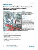
| dc.description.abstract | The accurate quantification of current and past Himalayan glacier mass budgets is vital if we are to understand the evolution of the Asian water tower, which provides water to the planet’s most populous region. In this work, we generated a geodetic time series spanning six decades over 79 glaciers surrounding Mt. Everest and found consistent acceleration of glacier mass loss between the 1960s (−0.23 ± 0.12 mwe a−1) and the modern era (−0.38 ± 0.11 mwe a−1 from 2009 to 2018). Glacier mass loss has varied depending on glacier terminus type and surface characteristics, and glacier thinning is now occurring at extreme altitudes (>6,000 masl). Our time series also captures the first documented surge of a glacier in the Mt. Everest region. These multi-decadal observations of glacier mass loss form a baseline dataset against which physically based glacier evolution models could be calibrated before they are used for predicting future meltwater yield. | |
| dc.format.extent | 13 | |
| dc.format.extent | 10178975 | |
| dc.language.iso | eng | |
| dc.relation.ispartof | One Earth | en |
| dc.subject | Mt. Everest | en |
| dc.subject | Glacier mass balance | en |
| dc.subject | Declassified satellite imagery | en |
| dc.subject | Glacial lakes | en |
| dc.subject | LiDAR | en |
| dc.subject | G Geography (General) | en |
| dc.subject | DAS | en |
| dc.subject.lcc | G1 | en |
| dc.title | Six decades of glacier mass changes around Mt. Everest are revealed by historical and contemporary images | en |
| dc.type | Journal article | en |
| dc.contributor.institution | University of St Andrews. School of Geography & Sustainable Development | en |
| dc.contributor.institution | University of St Andrews. Environmental Change Research Group | en |
| dc.contributor.institution | University of St Andrews. Bell-Edwards Geographic Data Institute | en |
| dc.identifier.doi | https://doi.org/10.1016/j.oneear.2020.10.019 | |
| dc.description.status | Peer reviewed | en |
| dc.identifier.url | https://www.sciencedirect.com/science/article/pii/S2590332220305492#appsec2 | en |
| dc.identifier.url | https://www.sciencedirect.com/science/article/pii/S2590332220305492 | en |
This item appears in the following Collection(s)
Items in the St Andrews Research Repository are protected by copyright, with all rights reserved, unless otherwise indicated.

